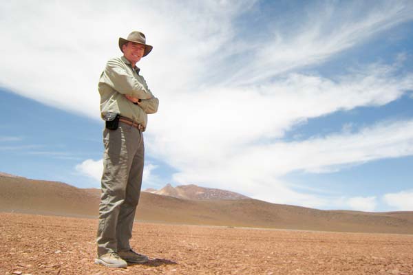
Nick Eyles explores "the country of our defeat"
Published: April 3, 2013
University of Toronto Scarborough Professor Nick Eyles enjoys taking viewers on a geologic journey. As host of the five-part CBC documentary Geologic Journey II he explored some of the most breathtaking and geologically significant sites in the world.
You can now watch him on a new documentary airing on TVO called The Land Between where he explores a unique stretch of land separating the Canadian Shield from the St. Lawrence Lowlands.
He recently sat down with writer Don Campbell to talk about his research and the place called the Land Between.
What got you interested in Geology?
When I was young we took vacations to the Dorset Coast in the south of England which is famous for its high, crumbling cliffs that contain world-famous fossils. It was a real inspiration. Geology also gave me an opportunity to get out of London and explore the world.
What is the “Land Between”?
It’s really a boundary zone between two vastly different worlds. It separates the rocky expanse of the Canadian Shield to the north from the farmlands of the St. Lawrence Lowlands where most people in Ontario live. It’s a unique ‘ecotone’ in Canada between two very different landscapes and ecosystems.
What does the land look like?
The land between is marked by bare limestone plains and shallow soil because during the last ice age, huge amounts of rock were ripped up by the ice sheet some 20,000 years ago and dumped everywhere. It’s also a transition zone with its own climate, ecosystem and geology that’s full of untamed wilderness, grasslands, swamps, cliffs, limestone plains and many caves.
Where is it located?
It’s a 25 to 30 kilometre-wide zone that stretches from Lake Simcoe to Kingston. If you were to take Highway 7 east of Peterborough you would drive along much of it.
Why is generally so little known about this stretch of land?
There’s a few reasons. First, the uniqueness of the ‘land between’ and its ecosystems has only been recognised in the last decade but it also has a checkered, unloved past.
It’s the land Al Purdy described in his classic poem (The Country North of Belleville) as “the country of our defeat.” It’s full of ghost communities and abandoned farms where settlers were sold tracts of land by rapacious land agents in the 1870’s, most of whom had never visited the land in the first place but advertised it to land-hungry Europeans as good farmland. It became known as ‘last chance territory.’ The soil is so thin that it was impossible to grow anything forcing most to pull up and leave or turn to logging or prospecting for minerals.
So historically, aside from some Group of Seven artists who later celebrated its scenery as a place of solitude for city dwellers, this land contains a story of heartbreak. Early settlers spoke of the difficulty of ‘farming rocks’ and were conquered by an unforgiving landscape
Why is this stretch of land geologically significant?
Because it’s the place where billion-year-old rocks of the Shield get covered by 500 million-year-old limestones. The Shield rocks are unusual because they expose the deep roots of mountains similar to the modern day Himalaya that were later eroded.
Geologists come from around the world to walk over and sample rocks that once lay 20km underground. Overlying limestones are the ancient remains of massive inland seas like nothing that has existed since and which stretched from coast to coast. These rocks are rich in fossils in contrast to the much older rocks below and record the great diversification of marine life after the so-called Cambrian explosion when animals make their first appearance.
What can we learn from studying this area?
Well, through the use of satellite imagery we can not only map the rocks better but we can also see the Earth’s surface in a different light. Not surprisingly those data are a gold mine of information about how the planet has evolved.
The Land Between is a wonderfully preserved fossil glacial landscape that was deeply scoured by 2 km-thick ice sheets during successive ice ages. These are the footprints of so-called ‘ice streams’ like those that occur in the modern Antarctic and Greenland ice sheets. So the name Land Between is very appropriate because it not only informs us of how modern ice sheets ‘work’ but also ancient ones as well.