Predicting tornadoes months or even seasons in advance
Published: August 13, 2015
A new model for predicting tornado activity could allow experts to prepare forecasts months or even seasons in advance, researchers at the University of Toronto say.
“The aim is to predict ahead to the following year or subsequent years about whether we’ll get above or below average tornado activity in a given area,” said Vincent Cheng, a postdoctoral fellow in the Ecological Modelling Lab at the University of Toronto Scarborough (UTSC).
Developed by Cheng, Professor George Arhonditsis and Professor Bill Gough in UTSC’s Climate Lab along with colleagues at Environment Canada, the model uses large-scale atmospheric variables like those used by weather forecasters. But instead of trying to predict a tornado on any specific day, it looks at variations in monthly and seasonal tornado activity relative to changes in atmospheric conditions over the same period.
Cheng said the model predicts how different conditions in the atmosphere during a thunderstorm will affect the risk of a tornado. The key variables the model relies on includes the instability of the atmosphere and vertical windshear, which is the change in wind speed and wind direction at different heights. These variables are important since there’s a much higher risk of a tornado taking place when air is able to rise quickly coupled with a big change in wind speed and direction at different heights above the ground.
Cheng’s model also takes into account the lack of accurate records in tracking tornadoes. Tornado reports rely solely on eyewitness observations, which means they’re better monitored in more populated areas. The model bypasses that by showing the strong relationship between atmospheric variables and actual tornado occurrences.
The result sheds light on why actual tornado activity in Canada is vastly underestimated.
“From observations there are only about 60 reported tornadoes in Canada per year, but that number is more like 150,” said Cheng (pictured below). “When we apply the model to areas where the monitoring network is lacking we find the greatest difference is in the Northern Great Plains and the Canadian Prairies.”
[photo of Vincent Cheng with computer screens showing tornado]
Cheng said there is also a significant data gap in northwestern Ontario and that more attention should be paid to that part of the province. The model is explained in a research paper that was published in the journal Nature Communications.
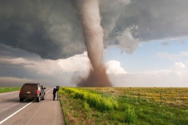
While much remains unknown about how tornadoes actually form, when one does it produces a narrow, violently rotating channel of air that runs from the base of a thunderstorm to the ground. They are one of nature’s most hazardous weather events, capable of causing significant destruction and devastation including severe injuries or death.
Canada is second only to the United States in the number of tornadoes experienced, with more than half of them ocurring in the Prairies and Northern Ontario and a third in Southern Ontario.
The goal, said Cheng, is to be able to predict whether there will be above-average or below-average tornado activity in a given area over a given time. This information can play an important role in disaster planning or determining how resistant to tornadoes buildings need to be in a given area.


