Can landscape design mitigate wildfires? U of T student says yes
Published: July 18, 2016
During a trip to Adelaide, Australia in 2015, Jordan Duke witnessed her first wildfire.
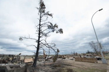
“We were driving over a hill and I could see a large plume of smoke in the horizon,” she said. “Thousands of hectares were on fire.” From the plane, the next day when she flew out, Duke was struck by the vast expanse of charred earth. She thought about it the entire flight home.
As a student in the Master of Landscape Architecture program at the John H. Daniels Faculty of Architecture, Landscape, and Design, Duke wondered: what could landscape architects do to help mitigate wildfire disasters? In the wake of the fire that struck Fort McMurray in Alberta in May, it’s a question that carries increased relevance — particularly since wildfires are predicted to increase in the future.
For her thesis project the following year, Duke researched how wildfires could be mitigated through tools that exist within the realm of landscape architecture. Her research culminated in the development of a strategy for Cleland Conservation Park. The park is based in South Australia where in February 2009, wildfires claimed over 170 lives. Her plan — which combined remote sensors embedded in the landscape with site-specific landscape design strategies that would produce both short- and long-term results — projected new possibilities, not only for the field of landscape architecture but also for how we could diminish such disasters in the future.
“There’s a lot of planning when it comes to wildfires in terms of where to build neighbourhoods, and there are many techniques to track and evaluate an area’s likelihood of burning, but I found that there were few systems in place to reduce the risk of a large wildfire occurring in the first place, “ says Duke.
Inspired by her work the previous summer at the Daniels Faculty’s Green Roof Innovation Testing Laboratory (gritlab), the first part of her strategy included embedding remote sensors within the landscape that would allow for real-time monitoring of data such as humidity, wind, temperature, vegetation density, and water availability — factors that contribute to the likelihood of a fire.
“At gritlab, we learned that sensor technology is cheap and easy to deploy. I had no computer engineering background, but by the end of the summer, we were installing sensors throughout the green roof, downloading data and doing analysis,” says Duke. “This triggered an idea: what if we could take these sensors and deploy them across a huge site to monitor variables that would let us know in advance when fires are likely to happen?”

Under Duke’s plan, data from the sensors would activate a variety of responses across the landscape. For example, on dry, hot days, weather modifiers installed along the ridges and valleys of the park would disperse mist across the site to increase humidity levels. Using the regular ocean breeze moving across the site, the modifiers would also scatter the seeds of fire-resistent cypress trees along the ridges of the landscape. Over time, the wall of trees that would eventually grow would become windbreaks that could help slow the pace of a fire.

Excess rainwater, which normally flows down the hills to the ocean during heavy rain, would be collected in reservoirs, which could become recreational pools for people visiting the park or sources of water for animals in search of refuge. When sensors indicate the risk of a fire in a particular location, however, the water would be released down the valley to soak the landscape below. The large amount of rapidly released water would also increase erosion runoff, thus creating firebreaks throughout the valley.
Duke also considered vegetation, which provides fuel for burning fires. Artificial watering holes strategically placed throughout the park would attract animals in times of drought. Native wallabies, kangaroos and other animals coming to the pools of water would then feed on nearby vegetation, reducing fuel for a potential fire.
“None of these devices eliminate risk,” says Duke. “Instead, they work to shift risk from large scale, catastrophic events to smaller, everyday risk levels.”
In addition to these and other tactics designed to mitigate risk, Duke explored ways to influence human behavior. The weather monitors along the ridge of the hill above the city, for example, could be programmed to light more brightly at night during periods of high-energy use.
“The idea is to change the collective consciousness of the local population by highlighting invisible phenomena and patterns that are contributing to climate change and wildfire occurrences,” says Duke. Energy consumption in the city of Adelaide is among the highest in Australia.

Jordan Duke (centre), with Dean Richard Sommer and Associate Professor Alissa North, Director of the Master of Architecture Landscape program, at the 2016 Graduation Awards Ceremony
While the scope of her thesis was to research and propose a new approach to mitigating wildfires, Duke does hope to one day build and test her project.
Her hope is that the strategy she devised will plant the seeds for ways that landscape architects can contribute to wildfire mitigation in the future.
“Developing science fiction scenarios are necessary,” says Duke. “Imagining what could be done is usually the first step towards something actually happening.”
Assistant Professor Liat Margolis was Duke’s thesis advisor. Duke received the American Society of Landscape Architects Certificate of Honor and the Canadian Society of Landscape Architects Student Award of Merit at this year’s graduation awards ceremony.
